


Up to 4 Weeks Free Base Rent*
Find your new home today!
*Select homes only. Applies to base rent only. Min. Term & restrictions apply. Pricing, availability, and offer may change. See leasing agent for details

Where is the station?
The Columbia City Station sits along Martin Luther King Jr. Way S, just east of Rainier Avenue and the neighborhood’s main commercial district. Many residents can walk to the station from nearby homes and apartments, or take a quick bus ride to the station. Arlo is only 0.4 miles from the station.
How long does it take to reach key destinations?
On the Link light rail, Columbia City connects directly to many of Seattle’s major destinations without transfers. Approximate travel times include:
Because the line runs north–south through the city, it’s one of the fastest ways to reach major employment centers, stadiums, and the airport.
How often do trains run?
Trains typically arrive every 8–10 minutes during peak commuting hours and about every 10–15 minutes off-peak, running from early morning until late evening.
How much does it cost?
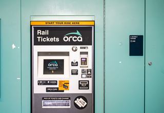
Fares depend on distance but usually range from about $2.25 to $3.50. Most regular riders use an ORCA card, which works across buses, light rail, and other regional transit systems.
Is there more than one station in Columbia City?
There is justone station serving Columbia City itself, the Columbia City Station. However, the neighborhood sits between two other nearby stations along the same line. All three stations sit along the same light rail line running through Seattle’s Rainier Valley:
You can easily combine light rail with Seattle’s extensive bus network for everyday travel. Buses run along the neighborhood’s main corridors and make it easy to reach nearby districts, local destinations, and places that sit beyond the rail line.
Where do buses run in Columbia City?
Most bus service in the neighborhood travels along two main streets: Rainier Avenue S and Martin Luther King Jr. Way S. These corridors run through the heart of Columbia City and connect the neighborhood with downtown, surrounding Rainier Valley communities, and other parts of South Seattle.
What are the main bus routes serving Columbia City?
Several King County Metro routes pass directly through the neighborhood and provide convenient connections across the city. Together, these routes provide direct bus access to both downtown Seattle and surrounding neighborhoods.
How often do buses run?
Service varies by route, but major lines like Route 7 typically arrive every 10–15 minutes for much of the day. Other routes generally run every 15–30 minutes, making it easy to catch a bus without long waits.
How do buses connect with light rail?
Many bus stops sit within a short walk of Columbia City Stationallowing riders to combine buses with Link light rail for longer trips across the city. This layered transit network helps residents move easily between neighborhood destinations, downtown Seattle, and other major employment centers.
How do you pay for the bus?
Just like the light rail, you can use an ORCA card, which works across Seattle’s regional transit system (including buses).
Not necessarily. Many residents rely on Link light rail, frequent bus routes, walking, and biking to get around. The neighborhood around Arlo apartments sits just 0.4 miles from the Columbia City light rail station and the main commercial district along Rainier Avenue, so everyday errands are pretty convenient.
For many Arlo residents, nearby transit and shopping convenience means a car becomes optional rather than essential.
The Arlo also offers parking and EV charging. Explore all luxury apartment floor plans and unique building amenities.


